ROSARITO HISTORY
In centuries past, the California peninsula was inhabited by tribes of natives, notably the Pai Pai, Cochimi, Kiliwa, Cucupa and Kumiai. The Kumiai settled in the area we now know as Rosarito naming it UACUATAY (which translates to "the big house") and trace of their everiday life such as arrowheads, stone kitchen utensils, mortar, etc., have been discovered. These artifacts provide a rich source of information regarding their lifestyles and the first stage in Rosarito’s evolution. Today, in the area of San Jose de la Zorra just 30 kilometers east of La Mision Village, descendents of the Kumiai can still be found.
The second stage in Rosarito’s evolution, referred to as the "Misional", began with the arrival of the Spaniards in 1533. So named because it marked the establishment of missions throughout the peninsula and the evangelization of the native tribes. A total of 28 missions were founded by the Jesuits, Dominican and Franciscan monks in what we know as Baja California.
In 1767 the Jesuits were expelled from Mexico in a political-religious decision, the Franciscans were asked to take over the administration of the missions. In 1772, a concordat (agreement) was signed between the King of Spain -with the support of the Viceroy of New Spain (Mexico) and the Pope- and the leaders of the Dominican and Franciscan monks resulting in the division of California in 1773, using the local mountain range that meet the sea at Calafia. The Palou Frontier was establish as the dividing line between Nueva (new) or Alta (upper) California and Antigua (old) of Baja (lower) California.
The Franciscans took control of Alta California and everything north of the Palou Frontier (including what we now recognize as the State of California, USA) was their domain. Alternately the Dominicans controlled everything south of the frontier in Baja California. Fifteen years later, en 1788, the De Sales Frontier was establish and the boundary between the two Californias was relocated to the site of the Rosarito Creek.
The third stage in Rosarito’s history began with the establishment of the big Ranchos. The property of El Rosarito Ranch, granted to don Jose Manuel Machado on 1825, stands out as the first in the area. Subsequently his son, don Joaquin Machado, applied for tittle to the land to then President Porfirio Diaz, and, on May 14th, 1885, tittle was granted and registered in la Rosarito de Todos los Santos, then capitol city of Baja California. May 14 is now recognized and celebrated as Rosarito’s Foundation Day by the Historical Society of Rosarito.
The fourth stage of Rosarito’s history is known as the TOURISTIC. It began with the stablishments of a place by the name or Rene’s in 1925 and the Rosarito Beach Hotel in 1926. Rosarito was visited by tourist since 1874 (San Diego Union), attracted by hunting (dear, quail and rabbit) and fishing (lobster, abulone).
The "Ejidal" and fifth stage in Rosarito’s history began with the inception of Ejidos (common land for farming) when, on August 17, 1930, General Lazaro Cardenas, then President of Mexico, issued a resolution granting 4,671 hectares (over 10,000 acres) of land to a community of local farmers known as Ejido Mazatlan.
The beginnings of urbanization in 1950 marks the sixth stage in Rosarito’s development with the planning and construction of streets and city blocks. As land sales soared, coupled with the construction of small restaurants, some shops and two hotels, the city began to take shape.
In the 1960’s Rosarito entered the commercial/industrial era with the constructions of a huge thermoelectric power plant and the later installations of Pemex, the Mexican Gas Company.
This seventh stage in Rosarito’s evolution was marked with further construction and the development of shopping centers and more restaurants and shops were stablished along the main street. This street has been renovated and enlarge to encompas four lanes and a lighted meridian strip and, in 1889, was officially designated Boulevard Benito Juarez.
During the seventies and early eighties, Rosarito’s growth was moderate but constant. The mid-eighties, however, was marked with the strong development of tourist related busnisses of obviously considerable investment. Available hotel rooms in Rosarito were up from 350 to 700.
In the early 1990’s appreciable economic growth was been achieved by the construction and competition of numerous hotels, condominiums and shopping centers.
Beginning the first day of December 1995, Rosarito converts from a Delegacion (suburb) of Tijuana, into the fifth Municipality (county) of the State of Baja California, being this the eight stage of the history of Rosarito. Now Rosarito has two "Delegaciones" (suburbs): Plan Libertador, just north of town, and Ejido Primo Tapia, south of town. With these two suburbs, Rosarito encompasses nearly 40 miles of coastline and the population has grow from 28,000 to more than 100,000 residents, according to 1992 census figures.
In addition to the natural appeal of Rosarito’s coastline, tourists are attracted by the more than 30 yearly sporting/touristic events, specifically designed for the visitor’s participation. The traditional Rosarito-Enseanda bike ride, for example, has drawn up to 19,000 entrants and finally became so pupular that there are now two rides, one in April and the original held in September. Three-wheeler competitions on the very famous Cantamar sand dunes in Primo Tapia, Bi- and Tri-athalons, 5 and 10K runs, nice volleyball on the beach tournaments, sand castle contests, sky-gliding and horseback riding are some of the other attractions to Rosarito. In addition to the nearly 500 shops for the acquisition of souvenirs of truly one-of-a-kind special remembrances of Rosarito, we can also find hand crafts market with more that 150 different shops, where you can find: sterling silver, leather goods, blankets and many other hand crafts from all over Mexico.
The fishing village of Puerto Nuevo (Newport), just 15 miles south of Rosarito proper, has become famous for its fresh lobster, fried and served with rice, beans and hand made flour tortillas. Rosarito’s restaurants, including those in Puerto Nuevo, number over 100 and offer everything from the Puerto Nuevo lobster previously mentioned, to the traditional Mexican, Chinese, Italian, French, Americn and Continental cuisine. This abundance of fine foods, promts the return of many visitors to Rosarito year after year.
Historical Sites in Rosarito:
1. - The mission of San Miguel Arcangel de la Frontera. Fourth dominican foundation in the old San Juan Bautista Valley, founded in 1787 by Fray Luis Sales. Constructed with adobe bricks, its site is located about 25 miles south or Rosarito.
2. - The dominican mission of El Descanso de San Miguelito. Eight foundation on may 18, 1814 by Fray Tomas Ahumada, located at the valley of El Descanso. This missions represents the relocation of the mission of San Miguel, about 9 miles south. Constructed with adobe bricks. The mission was abandoned in 1834. Its site is about 14 miles south of Rosarito.
3. - The house of the Machado family. Is the oldest house in the area, from the beginning of the 18th Century, located near the mission of El Descanso.
4. - The Fort and Presidium of El Descanso. Located in front of the mission of El Descanso, at the opposite site of the river, about 14 miles south of Rosarito. From this point the Bay of El Descanso was observed. Only a few stones remain and the sites represents the oldest cementery in the north part of the State of Baja California.
5. - The boundary of Palou. Group of large rocks, located about 2 miles from the ocean at the valley of El Medano (Primo Tapia). This place was marked as the first intermissional bounday of the Californias, on August 19, 1773. This boundary between Alta (upper) and Baja (lower) California, was moved on1778 to the creek of Rosarito, frontier that lasted until 1848, when the Guadalupe- Hidalgo Treaty, put an end th the war between United States and Mexico, establishing the third borde line, now a political one at a marine legue south of the Bay and Port of San Diego (now the San Diego-Tijuana boundary).
6. - Creek of Cantamar and the old ranches at the Valley of El Medano. Old houses and ranches remain, mainly own by the Gilbert family.
7. - The Historical, Cultural and Touristic Center of Calafia. The place that is mentioned as to the “point that leads to the sea...” where the first boundary of the Californias ended.
8. - Creek of Rosarito. Place where the second intermissional boundary was established, in1788.
9. - Old ranches at the Rosarito creek. El Toro, San Patricio, La Avena, Las Delicias all ranches own by the Machado family, descendents of the founders of Rosarito.
10. - Uacuatay creek. Place where the natives Kumiai were settled. Arrowheads, mortars and stone utencils have been found.
11. - Touristic stablishments, more than 50 years old. Rene’s cantina and the Rosarito Beach Complex.
Source: Sociedad de Historia de Rosarito, A.C.
Rosarito Mexico Spotlight
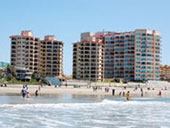
Rosarito Inn
Rosarito Inn has fully furnished 1-4 bedroom beach front suites. Your family and friends can share and stay together. Amenities include: beautiful ocean views, beach access, gated entrance, high speed internet, washer/dryer, cable TV/DVD, swimming pool, adult Jacuzzi, children’s wading pool, Oceana Grill and Cafe, fitness center, business center, bilingual staff, 24 hour security. Located next to Papas and Beer...More
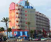
Rosarito Hotels & Lodging
With its almost perfect year round weather come and enjoy Rosarito’s luxury hotel and resorts with every amenity to oceanfront condos, hotels and RV parks...More